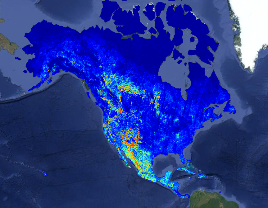
The Allen Institute for AI (Ai2) announced the launch of the OlmoEarth Platform on July 28, 2026, via a blog post on Hugging Face. This platform provides infrastructure for fine-tuning, evaluating, and performing large-scale inference with geospatial models. It is built to support organizations that may lack the extensive infrastructure or engineering teams required to manage the full lifecycle of Earth observation models, from data labeling to large-scale inference.
Ai2's OlmoEarth models are a family of Earth observation foundation models, which have been pretrained on approximately 10 terabytes of multimodal satellite data. These models are already being adapted by governments, NGOs, and other mission-driven organizations for applications such as deforestation monitoring, food security, and wildfire risk assessment.
Key Points
- The OlmoEarth Platform is designed for geospatial model fine-tuning, evaluation, and large-scale inference.
- OlmoEarth models are Earth observation foundation models pretrained on approximately 10 terabytes of multimodal satellite data.
- The platform can perform inference across continent-scale areas in roughly one day, processing dozens of terabytes of imagery.
- Inference costs are reported to be fractions of a penny per square kilometer.
- A recent wildfire risk map for North America used approximately 19,600 CPUs and 994 GPUs in parallel, achieving a 155x speedup.
- This North America wildfire risk map reduced an estimated 4,737 hours of serial compute to about 30.5 hours of wall-clock time.
- The platform divides inference jobs into three stages, each matched to a distinct hardware profile to optimize resource utilization.
Context
According to Ai2, while open models are sufficient for organizations with strong engineering teams, many environmental organizations lack the infrastructure to manage the full lifecycle of these models. Ai2's experience operating platforms like Skylight and EarthRanger informed the development of the OlmoEarth Platform, focusing on cost-effective model execution, performance monitoring, and turning raw outputs into actionable insights.
Why It Matters
The OlmoEarth Platform addresses the challenge of deploying large-scale geospatial AI by providing specialized infrastructure, enabling organizations without extensive engineering resources to leverage advanced Earth observation models for critical environmental and humanitarian applications. This can accelerate the adoption and impact of AI in fields like climate monitoring and disaster preparedness.
What To Do
- Note the stated processing capabilities of the OlmoEarth Platform for large-scale geospatial inference.
- Consider the reported cost-effectiveness of fractions of a penny per square kilometer for inference.
- Observe the hardware utilization strategy, which divides jobs into stages matched to distinct hardware profiles.
- Review the example of the North America wildfire risk map to understand the scale and speedup achieved.